

New toy for GPS tracks from Death Valley
Posted by Andy R. on April 01, 2003 at 19:43:28:
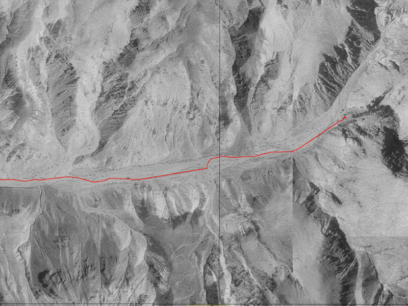
I just picked up a copy of Maptech's Terrain Navigator Pro. The really neat feature is the ability to take your GPS track and overlay it on a USGS Digital Orthographic Quad (DOQ). Now, not only can you see where you've been on a Topo map, you can use the DOQ to see an aerial picture of where you went.
Here's an example from Jail Canyon.
- Trail on the hillside Thom 11:07:23 04/02/03
(7)
- Re: Trail on the hillside maddog_bill 19:03:27 04/07/03
(0)
- Re: Trail on the hillside kilroy 18:55:27 04/04/03
(0)
- Re: Trail on the hillside Thom 09:31:14 04/03/03
(1)
- Re: Trail on the hillside thumper245 09:22:59 04/03/03
(2)
- Re: Trail on the hillside Panamint Charlie 23:57:52 04/02/03
(1)
- Re: Trail on the hillside maddog_bill 23:29:57 04/02/03
(2)
- Re: Trail on the hillside PanamintCharlie 17:30:12 04/02/03
(0)
- Re: Trail on the hillside maddog_bill 19:03:27 04/07/03
(0)
- Re: New toy for GPS tracks from Death Valley Andy R. 07:33:27 04/02/03
(0)
- Re: New toy for GPS tracks from Death Valley Panamint Charlie 01:00:41 04/02/03
(9)
- Re: New toy for GPS tracks from Death Valley Frazier Frankie 23:00:29 04/01/03
(1)
- Re: New toy for GPS tracks from Death Valley Arkose 02:26:13 04/02/03
(0)
- Re: New toy for GPS tracks from Death Valley Arkose 02:26:13 04/02/03
(0)
- Re: New toy for GPS tracks from Death Valley Lara 22:31:44 04/01/03
(1)
- Looks like the answer is no G.U. 23:31:44 04/01/03
(0)
- Looks like the answer is no G.U. 23:31:44 04/01/03
(0)